Taylor Akers
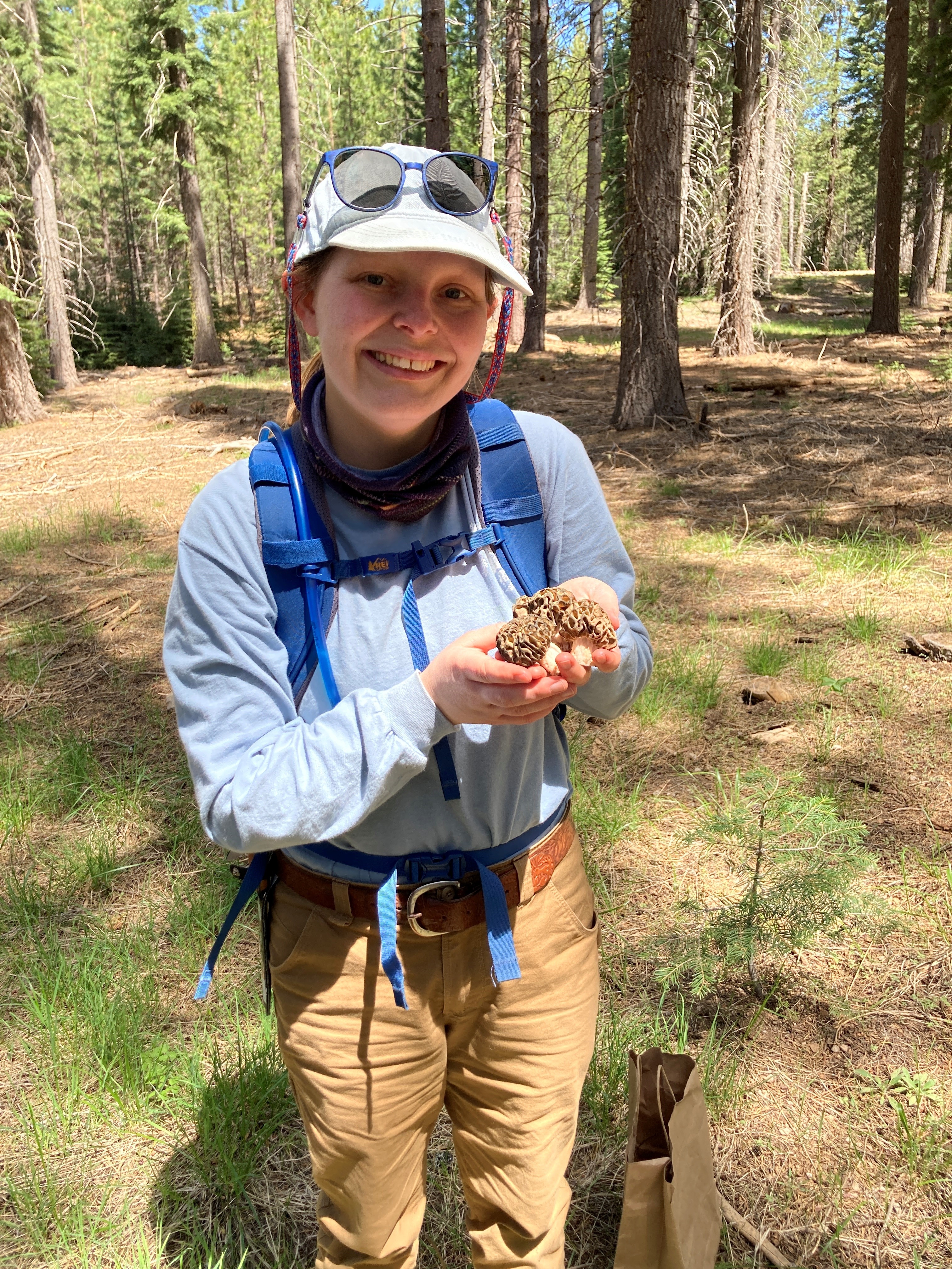
In Mount Shasta with some Morchella
About Me
Professional
What I do (present)
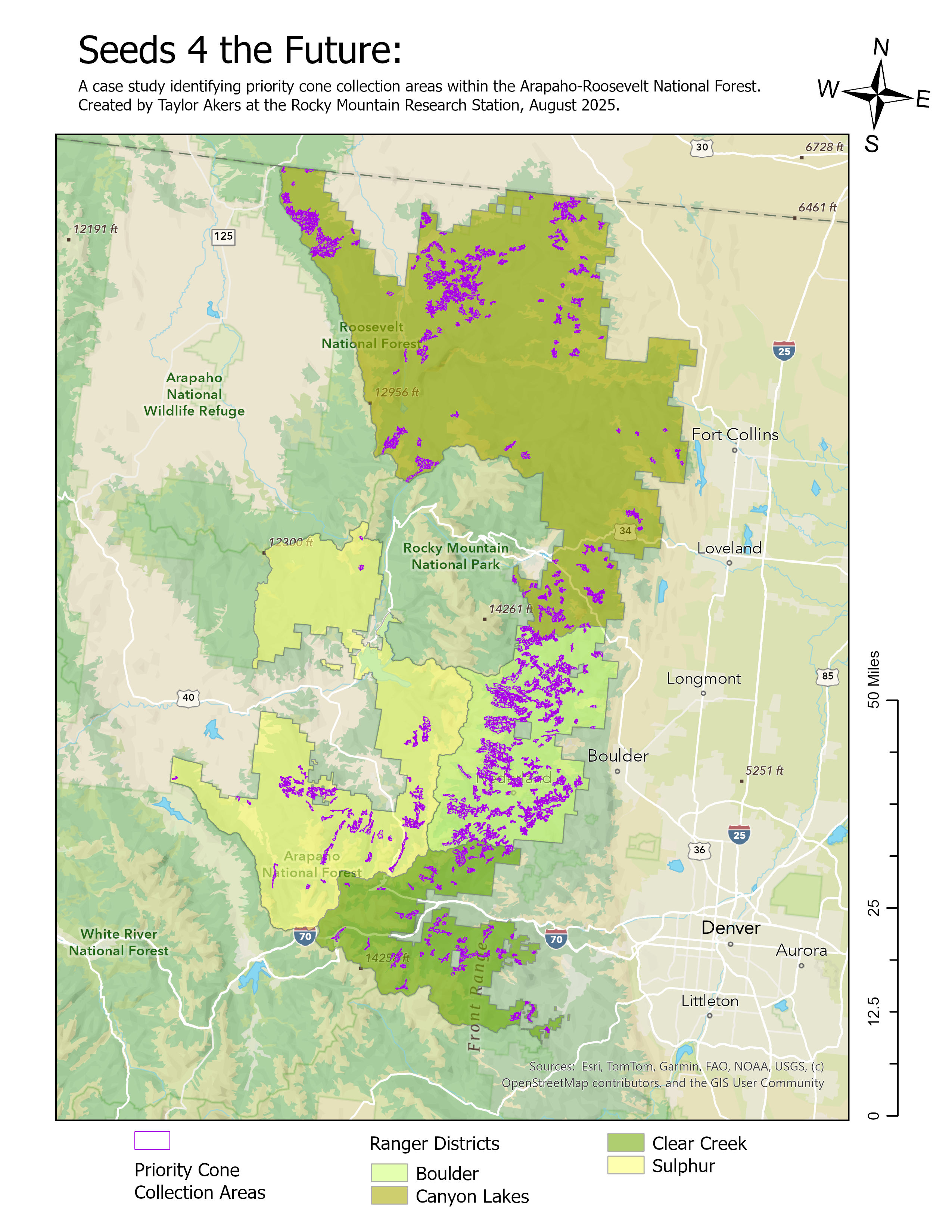
I am currently working as an ORISE Post-Master’s Fellow with the USDA Forest Service at the Rocky Mountain Research Station. My current research project will create spatial data resouces to help guide forest managers when planning for conifer cone collection as part of the reforestation pipeline.
Here is a map that I created using R studio and ArcGIS Pro to showcase pirority areas for conifer cone collection within the Arapaho-Roosevelt National Forest.
While at RMRS, I am gaining many new skills and am particularly focused on spatial data analysis. For example, I just finished a short course taught by Environmental Data Science Innovation and Impact Lab (ESIIL) and learned how to create this GitHub portfolio page and embedded interactive maps & graphs!
Here is graph that I made using Python programming language in GitHub’s Codespaces. It depicts temperature trends over the last century in Fort Collins, Colorado (my current home). During the course, I learned how to pull climate data from NOAA NCEI, specifically using this weather station located on the Colorado State University campus with records going back to 1893 as part of the Global Historical Climatology Network. You can see that the mean max temp in Fort Collins has risen over 2 degrees Fahrenheit over the last century!
What I did (past)
I started my career studying molecular biology at UC Santa Cruz and worked as an undergraduate in Dr. Al Zahler’s lab on a project with Dr. Matt Ragle studying gene regulation in C. elegans. I enjoyed the research in itself, but after graduating decided that I wanted to learn more about the world in a broader way and figure out my place in it. I traveled for a couple of years, working odd jobs, and then started teaching English in Spain where I lived for 3.5 years. Pandemic and etc brought me home to California and while taking care of family, I completed a Master’s of Science at CSU, Sacramento in Ecology, Evolution and Conservation Biology. For my thesis research, I studied the impact of fuel management treatments (prescribed fire and mechanical thinning) on soil fungal diversity in a mixed coniferous forest. Although the manuscript publication is still in progress, the published data can be interactively accessed through the Global Biodiversity Information Facility, GBIF and all the code I used in the analysis can be seen in my GitHub repo.
Just for fun, here is an interactive map of my alma matre, UC Santa Cruz, created with the HoloViews Python library: (buttons on top right allow zooming!)
What I want to do (future)
While none of us know what the future holds, I am keeping my options open and trying to remain flexible and hopeful for a more inclusive and supportive world. That being said, I will go where there is opportunity for me to continue working in ecology, conservation, and habitat restoration. I am interested in pursuing a PhD, but could also see working directly in land management, or I may do both with a roundabout path between. No matter what chapter is next, I hope to continue developing new skills while making a positive impact on the world.
Personal
Fun facts / interests
I am interested in all sorts of hobbies (writing, reading, speaking Spanish, mushroom hunting, aquarium keeping, vermicomposting) and activities (hiking, biking, gardening). What I am focusing on at this stage in life is to finish projects that I have started and not overstretch my energy - ¡poco a poco!
Contact
Connect with me on LinkedIn!